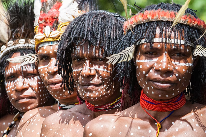
Vertical spirit in the Royal Cordillera
Three glacial giants of the Royal Cordillera: Pequeno Alpamayo, Chachacomani and Illimani.
Duration
21 days
From
€4,255/pers.
Ideal seasons
Jun, Jul, Aug, Sep
Style
Expeditions
Comfort
rustique
Travelers
Solo, With friends
The spirit of travel
You are experienced mountaineers, loving vast wild spaces. You wish to discover the mythic Cordillère Royale. This trip is ideal for you!
After acclimatization in a community on Lake Titicaca, you will set out to discover the most beautiful corners of this mountain range. Pequeño Alpamayo is the most aesthetic of all, Janq'u Uyu will delight climbing and glacier travel enthusiasts with its aerial and unprecedented traverse. Pacha Pata is a fairly short glacier course but offering its share of technicality.
And for great adventurers, you can embark on the thrilling crossing of the glacial massif between Janqu Uyu and Chachacomani, almost never visited. Adventure guaranteed! Chachacomani offers you a beautiful glacier course easy technically but physically demanding for this first 6000. And you will finish with the unmissable and mythic Illimani, protector of the city of La Paz.
The stages of your journey
Highlights
Day-by-day itinerary

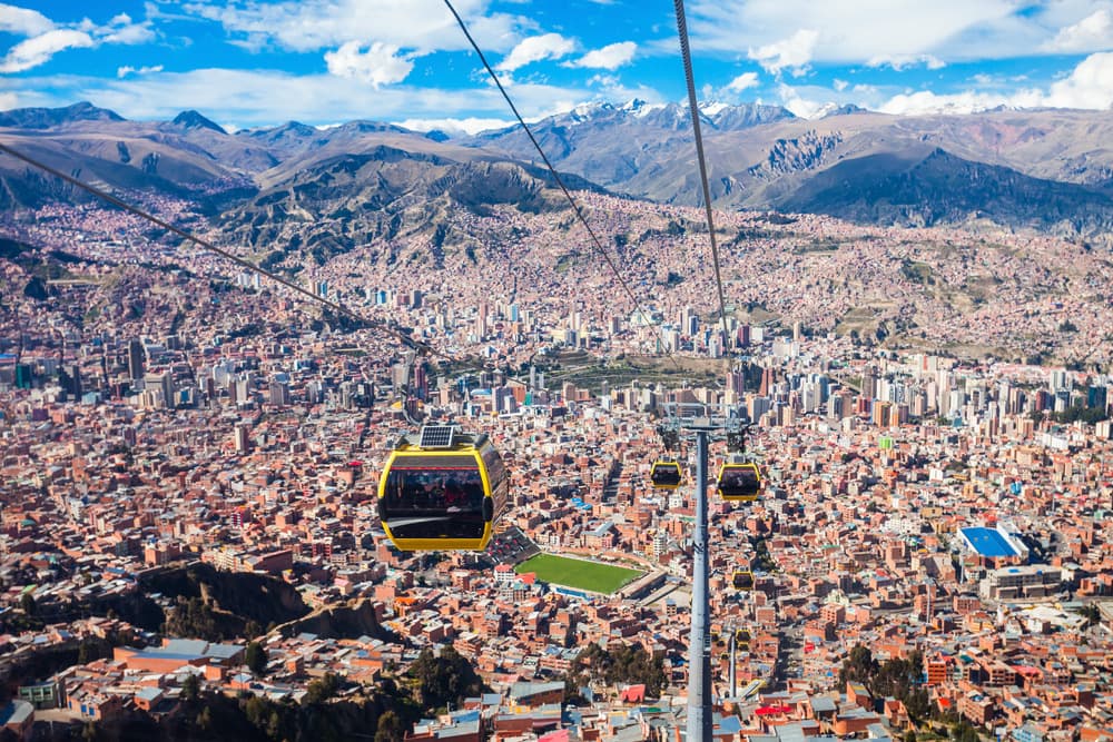
Art, Hiking and Markets in La Paz
We start this day by discovering the K'Illi K'Illi viewpoint which offers a magnificent view of La Paz and the Illimani massif.
We then descend into the southern area to meet a sculptor and watercolorist from La Paz, Ramon Tito. He works essentially with stone that he finds in the surroundings of La Paz: clays from the Valley of Souls, basalt, marble, sandstone, alabaster, granite… According to the shape of the stone he finds, he creates works that carry within them Bolivian identity.
We then set off on a hike in the Pedregal Canyon (3600m alt.). The climb is easy, in the midst of impressive fairy chimneys, up to a pass that opens onto El Valle Escondido (the hidden valley). We continue to the village situated at the foot of the Devil's Molar.
Hiking time: 2 to 3 hours
Elevation gain: +330m/-495m
To finish this beautiful day, afternoon dedicated to discovering on foot the traditional markets and the historic center of the city of La Paz.
In a rural community on the shores of Lake Titicaca
In the morning, drive in a private vehicle to reach the village of Santiago de Okola located in a magnificent bay dominated by the Sleeping Dragon hill, on the shores of the Lake Titicaca. Welcome by the community with whom we share lunch.
Early in the afternoon, we start our hike to Dragon Dormido with a climb to the Tunupa cave. Then we continue along a slightly steeper path to the summit which reaches 4095m. Magnificent view over Santiago bay. More challenging descent on the other side… truly a beautiful hike not to be missed !
Hiking time: 3 hours
Elevation gain: +230m/-230m
Back at the village we meet a weaver from the village who teaches us the technique of traditional weaving. It sometimes takes a month to weave an aguayo, traditional Andean fabric.
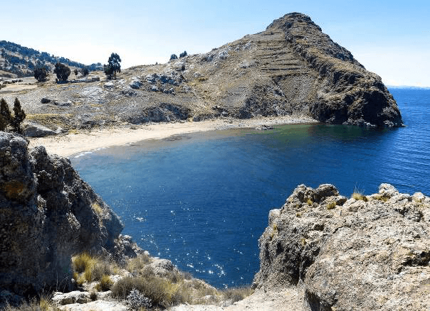
Hiking on the Heights of Lake Titicaca
After breakfast, hike along the shores of Lake Titicaca to reach Isla Tortuga. On the way, possibility to visit a small museum that showcases local culture. Beautiful hike that allows you to soak in the magic of the place. The view of the lake from the top of the island is impressive and gives the impression of an endless expanse of water.
Walking time: 3 hours
Return late morning to the community of Santiago de Okola to enjoy a typical lunch.
Return by private vehicle to La Paz.

Beginning of the trek in the Royal Cordillera: Laguna Khotia - Laguna Ajwani
Morning departure for the Laguna Khotia. Meeting with our muleteers team. From Laguna Khotia, the route to Laguna Chiarkhota is the most well-known in the Royal Cordillera.
From Laguna Khotia, the route to Laguna Chiarkhota is the most well-known in the Royal Cordillera. We start the day heading due south along the mountainside. We arrive at the Paso Contador pass (4760 m) which offers a beautiful view over a wide valley. Here we can observe a large lake named Alka Khota near the old Palcoco mine. We then descend into the valley, cross a semi-marshy area, near laguna Surakhota (4410 m) and continue southeast. We then need to climb along the mountainside before reaching laguna Ajwani ("lake of birds").
Departure: 10:00
Walking time: 5 hours
Elevation gain/loss: +550m/-385m
Ajwani Lagoon - Jurikhota Lagoon
Laguna Ajwani → Laguna Jurikhota
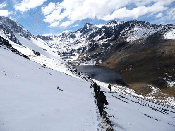
The Ajwani Lagoon is a beautiful lake where many ducks live. The place is very beautiful and peaceful. We start the day walking towards the southeast along the mountainside. We still have beautiful views of Ajawani Lake before passing into the next valley. We then reach the Milluni Pass located at 4910m altitude before descending to the Sistaña Lagoon (4670m altitude). From the pass, we can observe the Huayna Potosi and its famous west face. We continue towards the southeast. We climb a second pass, the Janchallani Pass located at 4885m altitude. We finally discover the Condoriri massif, one of the most beautiful glaciers in the Cordillera. We end this day by descending to the Jurikhota Lagoon (4700m altitude) nestled in a deep valley.
Departure: 9:00 AM
Walking time: 4 hours
Elevation gain: +530m/-445m
The Head and Left Wing of the Condor overlook the lake. We can make out the path that runs along the lagoon on the left and climbs up through the moraine to the foot of the glacier. The views are magnificent! Tomorrow's day promises to be splendid!

Laguna Jurikhota - Laguna Chiarkhota
Laguna Jurikhota → Laguna Chiarkhota
We start this day by walking along the lake, heading northeast, along its right bank to reach the moraine. Then we climb up the moraine to the Laguna Congelada (4880 m). The place is simply splendid. The Condoriri glacier ends its course in its turquoise waters. The vertical walls of the Left Wing and the Condor's Head appear frightening to us from our trail.
After a break, we then head southeast to climb among the rocks on our right towards the pass. The climb is quite steep and sometimes requires the help of your hands and a lot of caution. We arrive at the Austria Pass (5140 m). If we still have some strength left, it is recommended to make a detour to the Austria Peak (5300 m) before dropping into the next valley. This is the peak that dominates the pass on our right and faces Condoriri. You must tackle a steep climb in a scree field, but the effort is truly worth it. This peak is a true viewpoint over Condoriri. The views are breathtaking over the glacial massif. All that's left is to descend southeast from the pass to reach the Laguna Chiarkhota (4680 m), base camp for Condoriri and Pequeño Alpamayo.
Departure: 9:00 AM
Walking time: 5 hours
Elevation gain: +480m/-500m
Ascent of Pequeno Alpamayo (5370m alt.)
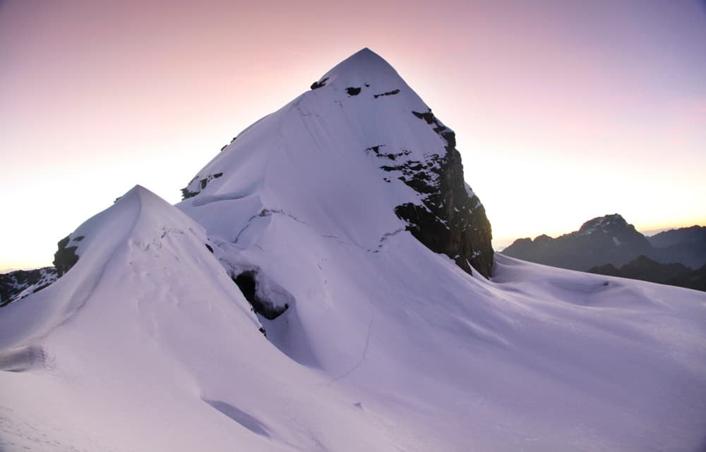
Ascent without technical difficulties except for the final slope from Pic Tarija (AD+/II). Departure at night (around 3am). We walk to the bottom of the valley (1 hour) to reach the glacier located at 4805m altitude. The climb starts steadily for a good hour on the dome up to a col (5245 m altitude) located above the bergschrund. Steeper ascent to Pic Tarija (5320m altitude) (2h30 to 3h00 from base camp). The view is splendid on the summit ridge. We descend a rocky section (approximately 50m) before climbing the impressive final slope (50/55º). 5 to 7 hours of ascent from base camp. 3 hours of descent to camp by the same route.
Departure: 3am
Walking time: 8 to 10 hours
Elevation gain: +935m/-935m
Laguna Chiarkhota - Laguna Janq'u Quta - Hike Cerro Wila Lluxita (5245m alt.)
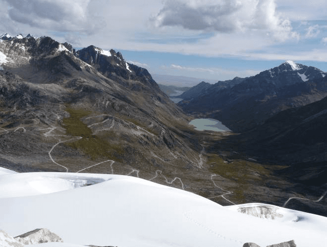
We gently descend to Rinconada.
Departure: 8:00 AM
Walking time: 1 hour
Elevation gain: +30m/-205m
Rinconada → Laguna Janq'u Quta
Then we leave by 4x4 vehicle to laguna Khotia. Then we continue northeast to the laguna Janq'u Quta (4715m alt.) located at the foot of the Paso Mullu. We set up camp on the shore of the lagoon.
Normally to carry out the ascent of Janq'u Uyu, you have to sleep a little higher, around 4900m altitude, at a pass. The latter is very windy, it is preferable to sleep lower and go up by vehicle during the night to reach this pass.
Afternoon: acclimatization walk. The vehicle takes us up in 30 minutes to the foot of the Cerro Wila Lluxita. This massif, still glaciated but not for much longer, divides the valley in two: the Paso Mullu on one side which descends towards the Mina Fabulosa to the southeast and another pass further to the northwest which joins the tropical slope of the Cordillère and the massifs of Las Tres Marias and Negruni. The vehicle drops us off around 4960m altitude. Steep climb through the rocks to the glacier. We walk peacefully along the ridges oriented west-east by the glacier to reach the summit of Cerro Wila Lluxita which peaks at 5245m. Beautiful view to the northwest on the Janq'u Uyu, objective for tomorrow, and on the impressive Janq'u Laya. Further to the southeast, it is the glacier of Mullu Apachita that unfolds.
Walking time: 2 hours
Elevation gain: +285m/-285m
Crossing Janq'u Uyu (5515m alt.) - Laguna Leche Khota
Laguna Janq'u Quta → Laguna Leche Khota
Departure around 4 a.m. by vehicle to reach in half an hour the famous windy pass located at nearly 5000m altitude.
Today's ascent presents no technical difficulty for the glacial section and has a few technical and exposed passages on the rocky section (PD/I and IV/V on rock).
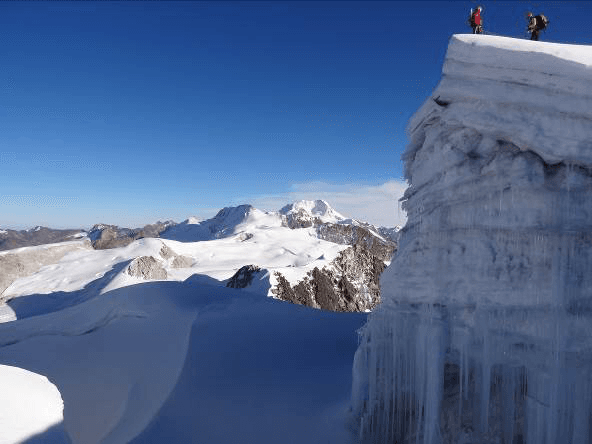
We head northwest. The approach walk is tricky through rocky chaos until we reach the glacier edge, which we attain in 1h30. Then the climb is very easy, still northwest, on the glacial dome with its nice rounded shapes. We reach the summit in 3h30 of walking from the start. This summit presents no technical difficulty and the slopes are very gentle (35º/40º maximum). The peak of Janq'u Uyu is perched on a splendid cornice overlooking the ridges of this glacial massif towards the northwest. The view is magnificent over the vertiginous walls of Chachacomani, Cerro Jakocire and Imasiña to the northwest, and over Huayna Potosi further to the southeast. The southwest face of Janq'u Laya is also impressive from the summit.
We then have the choice between descending by the same route and returning to sleep at laguna Janq'u Quta, or continuing along the ridges towards the northwest and descending into the valley towards the southwest to sleep at laguna Leche Khota. It will take us two hours to cross these sharp and sometimes exposed ridges. We will also have to tackle a technical and steep rocky passage. Then we descend smoothly onto the glacier towards the southwest at the foot of Jisk'a Pata peak in one additional hour. All that's left is to continue along the hillside to the beautiful laguna Leche Khota nestled at the foot of Jach'a Pata peak. Idyllic campsite on the shore of the turquoise waters of the lake.
Departure: 4:00 a.m.
Walking time: 8 to 9 hours
Elevation gain: +690m/-550m
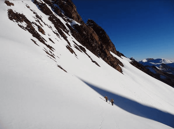
Ascent Pach'A Pata (5650m alt.) or rest
Ascent without technical difficulties except for the final slope (AD+/II).
The camp is nestled at the foot of a rocky ridge. A snow-covered pass separates two peaks. The one on the right, facing northwest, is the highest. This is the Pach'a Pata which reaches an altitude of 5650m. We set off in the morning around 5am. The climb is towards the southwest in the direction of the rocky ridge. We progress through the rocks to the upper lake. Then we continue through a rocky chaos until we reach the edge of the glacier which we reach after an hour of walking. The climb is quite easy until the pass located at 5510m altitude, by slopes inclined at 45º/50º (one hour from the edge of the glacier). It will remain to climb a beautiful slope inclined at 60º/65º for the last 150 meters of elevation gain. An additional hour will be necessary to reach the summit.
Breathtaking views to the northwest of the Cordillera, to the Illampu and Ancohuma massif, passing through Chearoco and Chachacomani. Magnificent! You can also admire the entire ridge system of Janq'u Uyu that we crossed the day before. And Wara Warani presents its rocky face to us.
Descent by the same route back to camp.
Departure: 5:00am
Walking time: 5 to 6 hours
Elevation gain: +500m/-500m
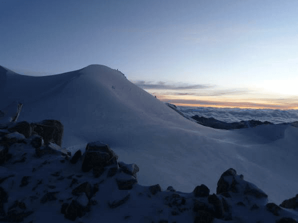
Laguna Leche Khota - Mt Umasiña (5600m alt.) - Chachacomani Base Camp
Laguna Leche Khota → Camp de base du Chachacomani
Ascent without technical difficulties for the glacial section and some technical and exposed passages on the rocky section (PD/II and IV/V on rock).
We head due west into the rocks, from Laguna Leche Khota. We first reach a plateau that overlooks the glacial valley and will lead us to the edge of the glacier in less than two hours, at around 5310m altitude. From there, we climb gently towards a huge glacial plateau that separates Janq'u Uyu from Chachacomani. The ridges of Janq'u Uyu appear behind us at sunrise. We then arrive at a first summit around 5455m altitude. The view is breathtaking for 360º. To the north, the glacial massif will lead us to the impressive ridges of Cerro Umasiña. We continue our route along a ridge line. After a second summit, located at 5505m altitude, we must pass an exposed rocky passage. Once the difficulty is overcome, we head towards a glacial valley (5410m) before climbing up to our final pass, located at 5600m at the foot of the Umasiña ridges.
From there, we can choose to descend by glacier to the Chachacomani valley and its base camp. The other option is to haul ourselves onto the ridges of Umasiña and follow them to descend above the Chachacomani base camp. Beware, this variant is exposed and engaging on the rocky ridges.
Departure: 4:00 AM
Walking time: 10 to 11 hours
Elevation gain: +800m/-1360m
Option for those who do not wish to traverse the glacier: make the detour by vehicle with the cook and climb back to the Chachacomani base camp via Cruz Pampa.
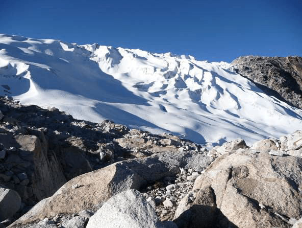
From base camp to high camp of Chachacomani
From the base camp, we head northwest towards the perpendicular valley. We quickly gain altitude. We arrive in a beautiful cirque crossed by a stream (4700m). We continue to the bottom of the valley around 4775m before climbing a steep slope due north. We then tackle this final ascent through rocky terrain. We arrive at the edge of the glacier. The location is splendid for setting up camp (5130m).
Departure: 9:00 AM
Hiking time: 3 to 4 hours
Elevation gain: +705m/-45m
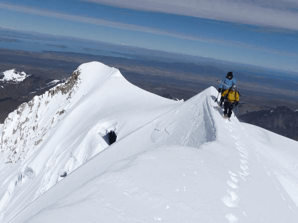
Ascent of Chachacomani (6074m alt.) and return to base camp
Ascent without technical difficulties but quite challenging (PD/III).
Departure in the night (around 1 am). From the high camp, we set foot on the glacier. The progression is steady heading northeast over a gigantic crevassed plateau. We must find the best path among the enormous crevasses to reach the foot of the Chachacomani ridges. We then set foot on the crests and follow them due east to reach the main summit (6074m). The slopes become sometimes slightly steeper, but never exceeding 45º. The view from the summit ridge is breathtaking from north to south of the Cordillera.
The descent is easily accomplished by the same route. Return to base camp in the afternoon. 5 to 6 hours of climbing from high camp. Descent to high camp (2h). Return to base camp (2h). Night at base camp.
Departure: 1:00 am
Hiking time: 9 to 10 hours
Elevation gain: +990m/-1650m
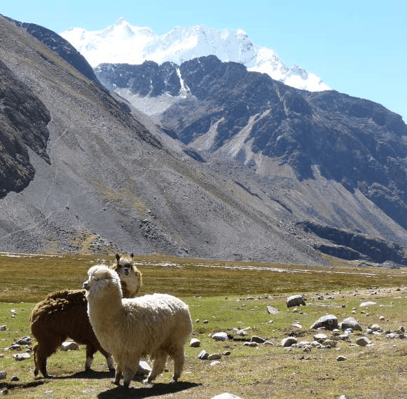
Return to La Paz
Return to the village of Cruz Pampa.
Departure 8:00 AM
Walking time: 2 hours
Elevation gain: +80m/-130m
Cruz Pampa (near Chachacomani) → La Paz
Return by private vehicle to La Paz.
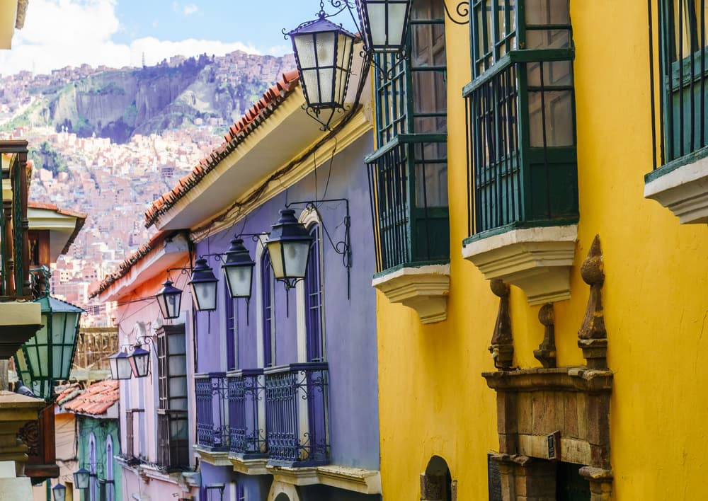
Towards the Illimani Base Camp
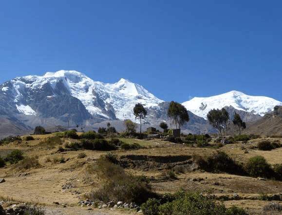
Departure for the small village of Pinaya (3880m alt.) at the foot of the Illimani Massif. Meeting with the team of muleteers and porters.
Peaceful ascent to Puente Roto, base camp of Illimani.
Hiking time: 2 to 3 hours
Elevation gain: +590m
From base camp to high camp of Illimani
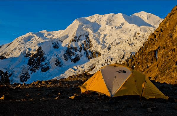
Climbing on the flanks of Illimani. Ascent to the Condors' Nest (5500m alt.) by a long steep rocky ridge. We start with a pleasant, well-marked path, skirting the north and central peaks of Illimani before crossing a plateau crisscrossed with streams then a curious orange moraine ! We walk in the company of porters, who go up and down tirelessly between base camp and high camp. A few more zigzags and we set foot on a rocky ridge at 4950m.
The rest is delicate and requires attention. Long ascent, steep in places, alternating rocky sections where you need to use your hands and short trails, until reaching the Nido de los Condores, the Condors' Nest. Camp on the edge of the glacier.
Departure: 9:00am
Walking time: 4 to 5 hours
Elevation gain: +1000m
Ascent of Illimani (6439m alt.) and return to base camp
A somewhat technical and engaging ascent (AD+/IV).
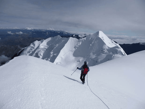
Departure in the night around 1 am. The climb is progressive along the snowy ridge on fairly steep slopes (45º/50º). It presents no technical difficulty, but is very demanding. The face is moreover on the western slope. Even at sunrise, the sun will remain hidden behind the summit ridges. You must therefore be very well equipped to face intense cold. Around 6300 meters altitude, we arrive on a glacial plateau situated between the central peak and the south peak. After a well-deserved break in the sun this time, we turn right to follow the summit ridge, heading south-east. The final ascent is steep (55º) before finally reaching the summit (6439m alt.). Arrival on the long summit ridge. 7 to 8 hours of climbing from Condor's Nest.
Descent to Puente Roto base camp (approximately 5 to 6 hours)
Departure: 1:00 am
Walking time: 12 to 13 hours
Elevation gain: +970m/-1970m
Walk to Pinaya and return to La Paz
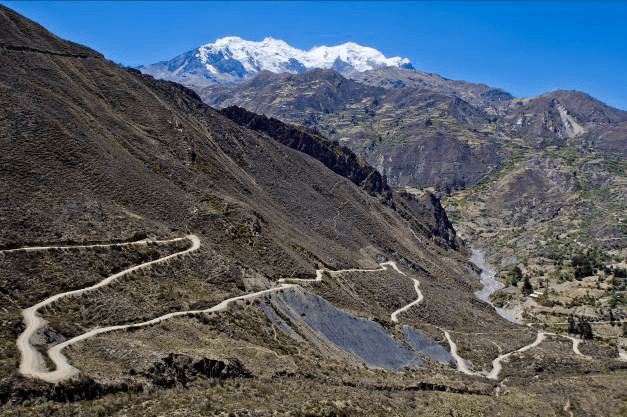
Descent to the village of Pinaya, our last hike of the circuit.
Departure: 10:00am
Hiking time: 2 hours
Elevation change: -590m
Return by private vehicle to La Paz.

Have a good trip!
Early morning free until transfer time to the airport for our return international flight.
Price per person
Indicative price per person, based on double room. Each trip is customized according to your preferences.
This trip can be tailored to your preferences
This itinerary provides an excellent foundation for discovery, but it can be fully customized. Our local advisors build each trip tailored to your budget, dates and preferences.
Not included
- The all-risks assistance-repatriation insurance
- Individual equipment necessary for the proper conduct of your stay
- The supplement for single room accommodation
- The international round-trip flight
- Tips for local teams
- Drinks and all personal extras
- The airport tax for domestic flights (3 US$ per person)
Included
- English-speaking local guide in La Paz and Lake Titicaca
- Spanish-speaking trekking guide in the Condoriri massif (3 days) + assistant guide from 5 clients onwards
- Cook for the trekking and climbing section + assistant cook from 5 clients onwards
- UIAGM certified high mountain guide Spanish-speaking for two clients
- Les transports privés mentionnés dans le programme
- Accommodation in hotels on a double or triple room basis in La Paz
- Meals described in the program
- Collective mountain and trekking equipment (tents, mess tents, catering, rope, etc.)
- Portage of individual and collective equipment (llamas, mules, porter and altitude porter)
Practical Information
Registration is considered firm and final after payment of a deposit of 30% of the total price and acceptance of the specific terms of sale.
The balance must be paid no later than 45 days before the departure date.
See our specific terms of sale for full details.
In the event of cancellation by the traveller, the following fees apply:
- Plus de 60 jours avant le départ : 40 % du prix total (acompte retenu)
- Entre 60 et 30 jours avant le départ : 50 % du prix total
- Moins de 30 jours avant le départ : 100 % du prix total
We strongly recommend taking out cancellation insurance. See our specific terms of sale for full details.
The information below concerns travelers who are nationals of the European Economic Area (EEA), Switzerland and Canada traveling to Bolivia for a tourist stay. Since entry rules may change, we recommend that you verify this information with the official authorities before your departure.
Passport
To enter Bolivia, your passport must be valid for a minimum of six months after your entry date into the country and must have at least one blank page for immigration stamps.
The document must be in good condition (no damaged, torn or altered pages).
Tourist stay without a visa
Nationals of the European Economic Area, Switzerland and Canada benefit from a visa exemption for tourist stays in Bolivia.
This exemption allows a stay of up to 90 days per year in Bolivian territory. This duration is calculated on a calendar year basis and generally cannot be exceeded without specific administrative procedures.
Authorities may also request:
an exit ticket from the territory (return or onward flight),
proof of sufficient financial resources for the duration of your stay.
Tourist card
Upon arrival in Bolivia, travelers may be asked to complete a tourist card or entry form issued by Bolivian immigration services, particularly when entering by land.
This document allows authorities to collect certain information necessary for entry into the territory:
passport information
purpose and duration of stay
address of first accommodation in Bolivia
It is advisable to keep this document throughout your stay, as it may be requested when leaving the territory.
Health and vaccinations
No vaccine is officially required to enter Bolivia from the EEA, Switzerland or Canada. However, vaccination against yellow fever is strongly recommended for travelers going to tropical lowland regions (Amazon, Beni and Santa Cruz departments).
It is also recommended to inquire about the risks associated with malaria in certain rural areas and to take appropriate precautions. The high altitude of certain Bolivian destinations (La Paz, Potosí, Uyuni) can cause altitude sickness (soroche): a medical consultation before departure is recommended.
Travel with children
Minors must hold their own valid passport covering the duration of the stay.
In certain European countries, when a minor travels without one of their parents, an authorization to leave the territory may be required according to the regulations of the country of residence. Bolivian authorities may also request documents proving the family relationship or parental authorization.
Other nationalities
Entry conditions may vary depending on nationality. Travelers concerned should inquire with the embassy or consulate of Bolivia in their country of residence.
To take part in our trips, it is strongly recommended that you have assistance-repatriation and foreign medical expenses insurance.
Your local agency encourages you to review the specific policy developed with our partner CHAPKA ASSURANCES and AXA ASSISTANCE.
To subscribe to insurance, learn about coverage and rates, follow the link below.
CAP EXPLORER: The comprehensive insurance solution designed for a worry-free trip!
Choose the plan that best suits you:
Explorer'Multirisque
Explorer'Annulation
Explorer'Assistance
Explorer' Complémentaire Carte Bancaire
Specific to our trips, we strongly recommend subscribing to them.
If you choose to subscribe to one of these plans, the policy detailing all coverage and claim declaration procedures is available on the insurer's website.
Your local agency will be aware of it, but only the participant is responsible for complying with the claim declaration procedures. The participant must therefore keep this policy with them throughout their trip.
Chapka — Cap Explorer
Our insurance partnerTravel with peace of mind with our partner Chapka. Cancellation, repatriation, medical expenses, baggage… All the coverage for a worry-free trip.
Travel with peace of mind — I'll handle the insuranceFrequently asked questions
Visitors can stay in Bolivia visa-free with a passport valid for at least 6 months beyond entry. The exact authorized length of stay varies depending on your nationality. Before booking, check the entry requirements applicable to your nationality with the Bolivian consular authorities.
Go to the My Trips section to find all your projects.
You can send a message to your host directly from the Tea Lounge.
For a tailor-made quality trip, budget between 130 and 220 euros per day and per person, including accommodation, meals, internal transport and English-speaking guide. International flights (1000-1400 euros return) are additional. Bolivia remains one of the most affordable Andean destinations.
Your documents are accessible in the Documents tab of your trip.
Absolutely. We adapt each itinerary to match our travelers' profiles. For families, we prioritize relaxed paces, family-friendly accommodations, engaging and educational activities, and comfortable private transfers. Our English-speaking local guides know how to capture children's attention with age-appropriate anecdotes.
It's simple. You exchange with our local team to define your wishes, budget and dates. You receive a detailed itinerary proposal within 48 hours. You adjust every detail together until it's perfect. You confirm and travel with peace of mind. Your local agency remains available 7 days a week throughout your trip.
In case of emergency, contact your local agency immediately.
Payment is generally made in two installments.
Our agency is part of the Nomadays network, registered in France. You benefit from APST (Association Professionnelle de Solidarité du Tourisme) guarantee which covers 100% of your funds. Secure payment, repatriation insurance included, and English-speaking assistance 24/7 on the ground throughout your stay.
Let's talk about your adventure — Cordillera Real
Explorer of the Bolivian Andes, based in La Paz, Bolivia
In Bolivia, the mountain is more than just beautiful: it forces you to slow down, to breathe differently, and to find your true place.
— Anne