Las Cuevas Beach
Las Cuevas Beach
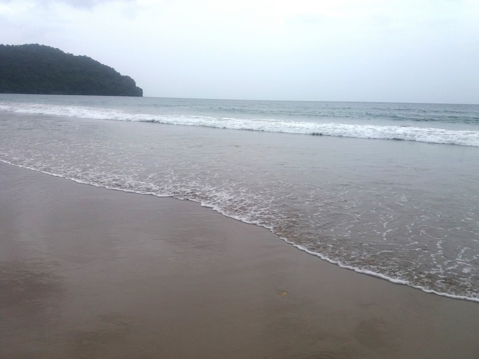
A crescent-shaped beach spanning 2.2 km on Trinidad's north coast, Las Cuevas combines calm swimming, seasonal surfing and leatherback turtle nesting.
Important note: Las Cuevas Beach is located in Trinidad and Tobago, on the north coast of the island of Trinidad, not in Bolivie. This crescent-shaped beach borders the Caribbean Sea, approximately 40 km north of Port of Spain.
Its Spanish name means "The Caves," referring to cavities carved by erosion at its southwestern tip. With its 2.2 to 2.5 km of golden sand, it is Trinidad's longest continuous beach, framed by the verdant hills of the Northern Range and a small fishing village.
Why visit Las Cuevas Beach
Unlike Maracas Beach, its busier neighbor, Las Cuevas maintains a peaceful rhythm. The site combines several advantages: a long beach where space is easily found, coconut palms offering natural shade, generally calmer waters on the eastern side, and a wilder western section favored by surfers in season.
The beach is also a nesting site for leatherback turtles, a protected species that can be observed at the end of the dry season with accredited guides. To the east, Abercromby Point promontory preserves the remnants of a former British fort, a testament to the island's colonial past.
What to see and do
The caves
At the southwestern tip, the rock formations that gave the beach its name lend themselves to a short exploration. Local tradition recounts that they may have served as refuge for smugglers and pirates, though no discovery has ever validated the legend. Access depends on the tide: check locally before venturing in.
Leatherback turtles
Trinidad and Tobago is one of the Caribbean's primary leatherback turtle nesting sites. These marine reptiles can reach 1.80 m in length and weigh several hundred kilograms (up to approximately 700 kg for the largest documented specimens). The observation period runs from March to August, with a peak around late May. Be sure to use an accredited guide: approaching nests without professional guidance is regulated by local law.
Surfing and swimming
The supervised eastern section is suitable for family swimming. On the west side, more exposed, waves can reach 1.5 m between November and April: this is the prime window for surfing. Snorkeling remains limited (no notable coral reef) but allows for spotting tropical fish near the rocks.
Hiking and fishing village
The surrounding hills offer short trails with views overlooking the Caribbean Sea. The neighboring fishing village allows you to purchase fresh fish directly from fishermen late in the morning.
When to go
The dry season, from December to April, is the most comfortable period: clear skies, calm waters on the eastern side, regular waves on the western side for surfing. The rainy season runs from June to November; showers are frequent but often brief, and crowds are lighter.
For leatherback turtles, aim for late May. For surfing, November through April. For family swimming, any month during the dry season.
How to get there from Port of Spain
The beach is approximately 40 km from the capital, or 40 minutes to 1 hour's drive depending on traffic.
By car
The route passes via the North Coast Road, a scenic road that crosses the Northern Range and runs along Maracas Bay before reaching Las Cuevas. The road is winding but well-marked. Free paved parking is available at the beach entrance.
By bus
From the City Gate bus terminal in Port of Spain, certain north coast lines serve Las Cuevas. Specify your stop to the driver; stops are made on demand. Frequency is limited: allow extra time for the return journey.
By taxi
Maxi-taxis and private taxis are a practical alternative to avoid driving on mountain roads. Agree on the fare before departure and arrange your return.
Practical information
- Facilities: toilets, showers, changing rooms (eastern side), picnic tables under canopies, food kiosks, trash bins.
- Local specialty: bake and shark, a fried shark sandwich, sold at the kiosks.
- Supervision: lifeguards on duty during the day, mainly on the marked eastern section with flags. Respect designated zones.
- Parking: paved, free, with substantial capacity (up to approximately 200 vehicles).
- Environment: collect your waste, avoid collecting shells and corals, do not disturb turtle nests. Customs checks may be conducted on shells when leaving the country.
Nearby attractions
Trinidad's north coast features several beaches accessible from the North Coast Road: Maracas Bay (the most famous, about fifteen minutes back toward Port of Spain), Tyrico Bay and Blanchisseuse, further east, frequented by experienced surfers. The Northern Range interior houses waterfalls and hiking trails, notably around Brasso Seco.
Frequently asked questions
Frequently asked questions
Yes. The eastern section is supervised and offers generally calm waters. Toilets, showers, changing rooms and picnic tables make a day with children convenient.
Yes, between March and August, with a peak around late May. Observation must be done with an accredited guide to comply with regulations and respect the animals' tranquility.
The western section receives waves reaching up to 1.5 m between November and April. This is the best window for surfing. Outside this period, conditions are calmer.
Beach access and paved parking are free. Only kiosk purchases and any services (rentals, guides) are paid.
Plan for a half-day to a full day. Adding travel time from Port of Spain and a stop at Maracas Bay en route, the outing easily fills a day.
Plan your trip
Las Cuevas Beach ranks among the natural stops on a northern Trinidad coast itinerary. To build a complete itinerary, consult our travel ideas and other attraction guides for the region.
Interested in this visit?
We can include it in your personalised itinerary.