Larecaja
Larecaja
At the foot of Illampu and Ancohuma, Larecaja province unfolds high-altitude treks, Andean villages and a descent into the Bolivian Yungas.
Larecaja is a province in the La Paz Department. This part of Bolivia was founded by Marshal Antonio José de Sucre on October 18, 1826. The city of Sorata was immediately designated as its provincial capital. Today, Larecaja is home to approximately 67,000 residents.
History
In the 16th century, Spanish conquistadors took possession of the territory. By decisive order of the Spanish king, in collaboration with Holy Roman Emperor Charles V, control of the Inca lands was assigned to a diplomat named Pedro de la Gasca.
Geographic Location
Larecaja is subdivided into eight municipalities, some of which are further divided into cantons. The entire region notably includes the municipalities of Sorata, Guanay, Tacacoma, Quiabaya, Combaya, Tipuani, Mapiri and Teoponte. Each has its own distinctive characteristics.
Larecaja and Its Major Towns
Among the eight municipalities that structure Larecaja province, three of them constitute its largest cities.
The Town of Sorata
It stands as the first municipal section of Larecaja. It boasts one of the most stunning landscapes in the Bolivian Andes. Overall, Sorata represents the starting point for numerous treks. The place inspired Bolivian writer Villami de Rada, who described it as a primitive Eden.
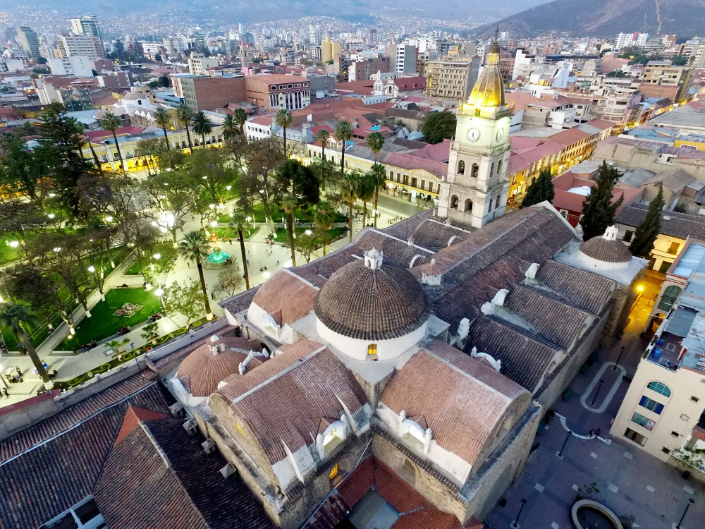
This once little-known destination is gaining recognition today. The main square, also called Plaza General Enrique Penaranda, is a point of pride for Sorata. With its imposing date palms and gardens such as Purani Churiquimbaya, it represents a true symbolic landmark.
Its geographic location attracts many trekkers and climbers, who fall in love with its verdant valleys and snow-capped peaks. Among these towering summits stand Illampu (6,362 m) and Ancohuma (6,427 m). These two peaks shelter the glacial lake (Laguna Glaciar), spanning an area of 0.2 km² and perched at 5,038 m. It has been ranked the 19th highest lake in the world.
If you're interested in visiting the surrounding areas, these places are sure to impress:
- The Tiwanaku archaeological site;
- Chacaltaya mountain;
- Cerro Huayna Potosi mountain;
- Sun Island on Lake Titicaca.
The Village of Guanay
You'll appreciate its pleasant far west atmosphere and the warm hospitality of its people. Guanay is distinguished by its town gripped by gold fever during the 1980s. The Kaka river winds through the village, along whose banks a former exiled head of state reportedly made his fortune. Across from a small port stand the ruins of a dredger that contributed to massive prospecting operations. Travelers will have the opportunity to discover numerous mines. Small shops located on the square buy directly from the products exploited by workers.
Guanay is also traversed by the Royal Cordillera. The region is bounded by two snow-capped peaks, Chachakumani, reaching 6,000 m, and Ch'iyar Juqhu, standing at 4,720 m. Together they create a splendid panorama with Lake Titicaca.
About a hundred kilometers away lies the Chaco region. It offers little attraction except for a surprising rare variety of fauna and flora. The southern zone contains significant natural resources such as gas and oil.
Climate
Larecaja province experiences a temperate climate. There is a short, cool summer period and a dry winter throughout the year. The average temperature hovers around 22.5 degrees Celsius.
Languages Spoken
Leko is an isolated Amerindian dialect of Larecaja, spoken by a very small minority of indigenous people living on the slopes of the Andes, particularly elderly persons. Today, Aymara, Quechua, and Spanish are the most widely used languages in the region.
By air, there are domestic flights to Larecaja from any airport in Bolivia's cities. The alternative is to make the journey by car.
Want to discover this destination?
Our local advisors design your tailor-made trip.