Ciudad Roma
Ciudad Roma
An isolated rocky site in the Bolivian South Lipez, nicknamed 'City of Rome' for its resemblance to the Italian capital, inhabited by llamas, vicuñas and Andean condors.
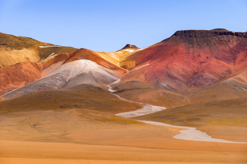
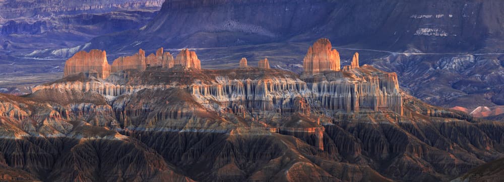
Located in the Potosí Department, near the Argentine border, Ciudad Roma is a natural site composed of rock formations sculpted by erosion. Nicknamed "Ciudad de Roma" or "City of Rome" because of its resemblance, when viewed from a distance, to the Italian capital, it remains one of the least frequented sites in South Lipez.
Why visit Ciudad Roma
The site's appeal rests on three elements. The first is its silhouette: an alignment of grey rocky columns, whose arrangement and coloring evoke Rome's skyline when observed from afar. The locals call it the "enchanted city."
The second is its isolation. Ciudad Roma is located at the far south of Potosí Department, on the territory of the San Antonio de Esmoruco municipality, in the South Lipez province. It receives few visitors compared to nearby sites like the Uyuni Salt Flat, making it an ideal stop for a Bolivian journey focused on Altiplano landscapes.
The third is its position on the "Ruta de los Condores," a tourism itinerary established by the Potosí Departmental Government, which connects several Andean condor observation sites.
What to see on site
Rock formations
The site covers an area of approximately 1,200 km², at an altitude exceeding 4,000 meters. The geomorphological formations result from rainfall erosion exercised over centuries on the rock: vertical columns, carved walls and what local guides call "natural cathedrals." The summit, bristling with rock penitents, bears a certain resemblance to the landscapes of the Algerian Tassili.
Wildlife adapted to altitude
The rock structures create microclimates that shelter flora and fauna more varied than an environment this arid would suggest. Along the dirt track connecting the two neighboring villages, it is common to observe llamas and wild vicuñas.
At sunset, the sky is regularly crossed by Andean condors, an emblematic species of the mountain range, which exploit updrafts to glide over long distances.
The surrounding landscape
The landscape is dominated by several snow-capped volcanoes, including the Cerro Lipez range, which peaks at nearly 5,900 meters. The neighboring communities—Rio Mojon, Seco, Oki Orcko de Quillacas, Guadalupe and San Antonio de Esmoruco—remain relatively underdeveloped from a tourism perspective.
When to go
The altitude imposes a cold and dry climate year-round, with temperatures ranging between -5°C and 10°C. The dry season, from May to October, offers the best visibility conditions and limits the risk of rain that makes the trails difficult. The wet season, from December to March, complicates access due to the state of the dirt roads.
Late afternoon hours are the most favorable periods for observing condor flight, when the raptors take advantage of the day's last thermal currents.
Practical information
- Altitude: over 4,000 meters — plan for prior acclimatization
- Temperatures: -5°C to 10°C, warm clothing and windproof jackets essential
- Equipment: hiking boots, water, sun protection (intense UV at altitude)
- Visit duration: allow half a day to a full day depending on the route
- Accommodation: limited capacity in nearby communities, arrange through an operator
How to get there
Ciudad Roma is approximately 250 km from Tupiza and 180 km from Uyuni. These two towns are the main departure points for a South Lipez circuit. The route uses dirt tracks, making a 4x4 vehicle and a driver familiar with the region necessary.
A local transport service connects the villages of Guadalupe and Esmoruco, but frequencies are irregular. The majority of travelers access the site via an organized excursion that includes accommodation and meals.
Nearby
- San Vicente — neighboring village associated with the legend of Butch Cassidy and the Sundance Kid: according to local oral tradition, the two American outlaws allegedly took refuge there after their flight from the United States and were buried there.
- Tupiza — classic departure point for South Lipez circuits, 250 km away.
- Uyuni and its salt flat, 180 km away, accessible as part of the same itinerary.
- The Chullpas de Pumiri, other remarkable rock formations in Bolivia.
- The Cerro Rico Mines in Potosí, to understand the mining history of the department.
Frequently asked questions
Frequently asked questions
The nickname comes from the resemblance of the rock formations, seen from afar, to the silhouette of the Italian capital: an alignment of columns, grey coloring and structures that evoke ancient buildings. The locals also call it the "enchanted city."
According to local oral tradition, the two American outlaws allegedly took refuge in the region after their escape from the United States and were buried in San Vicente, a nearby town. This version remains a regional legend, not a historically established fact.
Yes. The site is located above 4,000 meters. It is recommended to have spent several days at altitude (in La Paz, Uyuni or Tupiza) before traveling there, to minimize the risk of acute mountain sickness.
Independent access is difficult: dirt tracks, no signage, few facilities. The majority of travelers go through a local operator offering a 4x4 circuit in South Lipez with a driver-guide.
Condors are visible year-round, but late afternoons during the dry season (May to October) offer the best conditions, with clear skies and updrafts favorable for flight.
Planning your visit
Ciudad Roma fits logically into a South Lipez circuit combining the Uyuni Salt Flat, the Andean lagoons and Altiplano villages. To organize this stop with an operator familiar with the region, check our Bolivia travel itineraries.
Interested in this visit?
We can include it in your personalised itinerary.