Mont Nevado Sajama
Mont Nevado Sajama
Bolivia's highest peak at 6,542 m, Nevado Sajama dominates a national park rich in Andean wildlife, geysers, hot springs, and pre-Hispanic heritage.
The Nevado Sajama is a stratovolcano rising to 6,542 meters, making it Bolivia's highest peak. It stands in the Oruro Department in the western part of the country, at the heart of the national park bearing its name. The village of Sajama, nestled at its foot, serves as the starting point for climbs and hikes in the reserve.
Why visit Nevado Sajama
The site combines several rare assets in South America. The volcano dominates the Altiplano and offers a distinctive silhouette visible from dozens of kilometers away. On its slopes grows one of the world's highest forests, composed of Queñoa trees that can reach 5 meters and withstand extreme conditions. The park protects dense Andean fauna and harbors archaeological remains linked to pre-Hispanic pilgrimages. Add to this geysers and hot springs accessible during excursions.
History and anecdotes
The date of Sajama's last eruption remains uncertain, but the formation of the glacial cap dates back tens of thousands of years. The first successful ascent was accomplished by an Austrian rope team on October 4, 1939.
The summit also hosted an unusual event: in 2001, a football match pitted local villagers against Bolivian guides. A second tournament was organized on June 12, 2007, as a protest against FIFA's decision to ban matches at high altitude. Former president Evo Morales participated.
Another curiosity, the Sajama lines: a network of rectilinear paths numbering in the thousands around the volcano. They were reported by Argentine professor Aimé Felix Tschiffely. Work conducted in 1932 by Swiss anthropologist Alfred Métraux demonstrated that these are traces of sacred pilgrimage routes dating back approximately 3,000 years.
What to see in Sajama National Park
Sajama National Park is the oldest Andean park established in Bolivia. Its fauna is among the richest in the Puna, and numerous species appear on CITES and IUCN lists.
Flora and fauna
- Birds (nearly 70 varieties): Darwin's rhea, giant parina, woodpecker (Picidae)
- Mammals (over 20 categories): Andean armadillo, taruca, titi, vicuñas, pumas, Andean foxes, skunks, coatis, as well as vast herds of llamas and alpacas
- Endemic fish from marshlands: the burruchyalla and suche
- Queñoa forest on the volcano's slopes
Geothermal features and archaeological sites
The reserve features several geysers and hot springs, frequented at day's end after hikes. The park also preserves chullpas, pre-Hispanic funeral structures scattered around the village. A detour to the Montecielo viewpoint allows you to take in the entire massif, provided you are acclimatized to the altitude.
Twin Payachatas peaks
To the southwest, the Parinacota and Pomerape volcanoes, nicknamed Payachatas, exceed 6,300 meters and mark the natural border with Chile. They complete the panorama from the village.
When to visit
The dry season, May to September, remains most favorable for hiking and climbing: clear skies, passable trails, enjoyable hot springs after exertion. Nighttime temperatures drop well below freezing; prepare appropriate gear. The rainy season (December to March) makes trails difficult and limits climbing opportunities. The most stable window for a summit attempt typically falls between June and August.
Practical information
- Acclimatization: allow several days at altitude (La Paz, Oruro, or the village of Sajama at approximately 4,200 m) before any summit attempt
- Level: the summit climb is demanding (crevasses, steep slopes, ice) and requires roped climbing with a certified guide over 2 to 3 days
- Alternative hikes: circuits around the village, hot springs, lagoons, and chullpas, accessible on foot or by 4x4
- Equipment: crampons, ice axe, harness, and cold-weather clothing for the summit; sturdy hiking boots and windproof jacket for hiking
- Park entry: an access fee is collected at the entrance, payable in bolivianos
- Accommodation: small hospedajes and community lodges in the village of Sajama
How to get there
From La Paz, access is in two stages. A first bus connects La Paz to Patacamaya, on the route toward Oruro. In Patacamaya, a second bus provides daily service to the village of Sajama (approximately 4 additional hours). Departures typically occur in the early afternoon; it's best to check the day before as schedules vary. With organized travel, access is by 4x4 from La Paz or Oruro, which simplifies logistics during high season.
Worth combining with
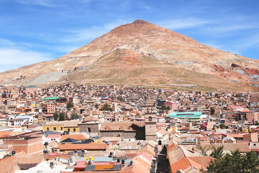
- A visit to the Cerro Rico mines in Potosí, another emblematic site of the Bolivian Altiplano
- A detour to the Valley of the Moon near La Paz, on your outbound or return route
- For enthusiasts of geothermal phenomena, the Tatio geysers on the Chilean side extend the volcanic experience
Frequently asked questions
Frequently asked questions
Plan your trip
To incorporate Nevado Sajama and the national park into a complete Altiplano itinerary, consult our bespoke trips to Bolivie.
Interested in this visit?
We can include it in your personalised itinerary.